
Using the captured point cloud data, we developed a precise LOD 300 BIM model in Autodesk Revit. Both floors of the villa were modeled to exact measurements with the landscaping also incorporated to provide a complete digital representation of the property

The scan to BIM workflow begins with a 3D laser scanner that captures millions of precise measurement points of a space, creating a "point cloud". This point cloud contains immense amounts of data, with some scanners collecting hundreds of millions of points in just a few minutes. The point cloud is then imported into specialized software and registered, which means stitching together data from different scan locations to create a unified data set. From there, the point cloud data is used as a foundation to create a BIM model.
Scan to BIM is a valuable process in the architecture, engineering, and construction (AEC) industries because it provides a highly accurate and data-rich representation of a building. It's faster and less prone to human error than traditional manual measurements. Some of the key benefits include:
Improved Accuracy: It captures a detailed representation of the as-built conditions, which helps reduce errors and minimize costly rework during construction.
Enhanced Collaboration: The detailed 3D models allow architects, engineers, contractors, and clients to collaborate on a single platform, improving communication and helping to identify potential clashes early in the project.
Efficiency and Cost Savings: It streamlines workflows by making data collection faster and enables more accurate planning, which can lead to significant time and cost savings.

.png)
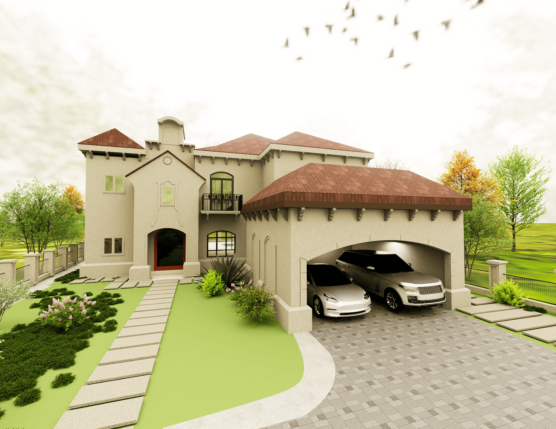
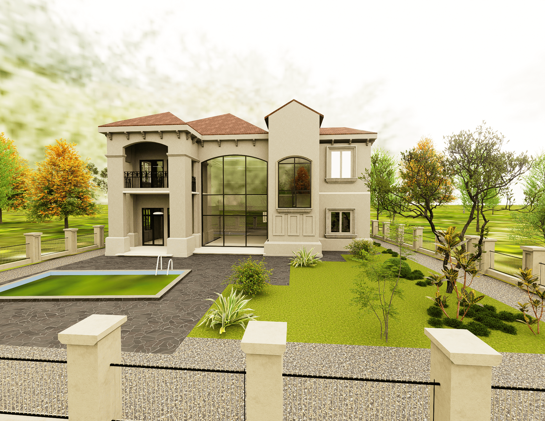
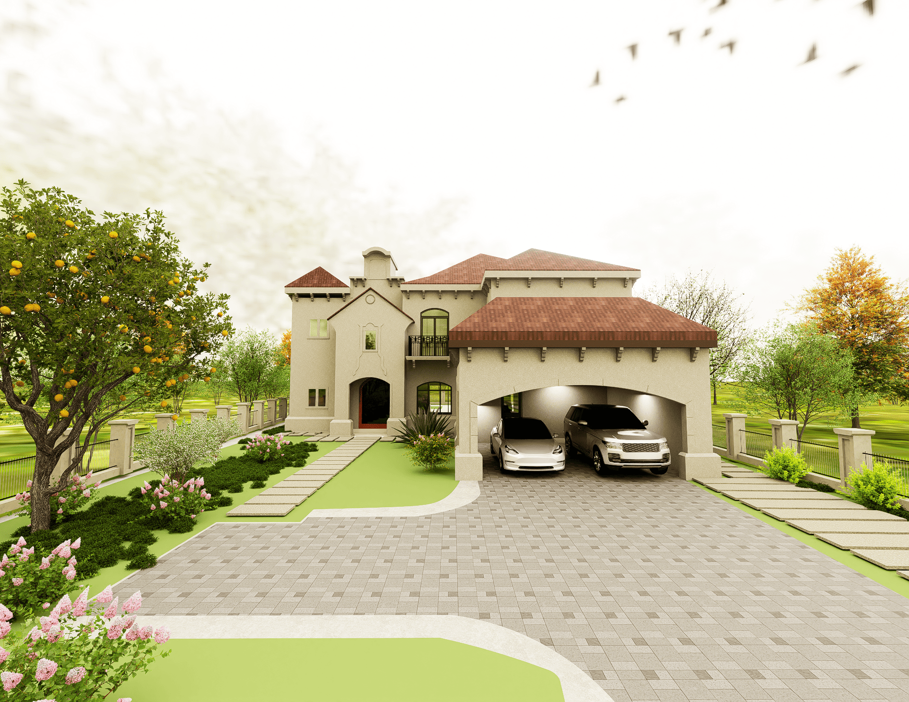
Our team was engaged to deliver a detailed Scan to BIM model for a luxury two-floor villa located in Jumeirah Island, Dubai. The client required an accurate and reliable BIM model of the property to support future design development and facility management needs.
The project commenced with a thorough laser scan of the villa and its surrounding landscape. The comprehensive on-site scanning, completed in just two days, captured the entire property and generated a dense point cloud of data. Following the scanning, our team registered the data and developed a precise LOD 300 BIM model using Autodesk Revit. The modeling encompassed both floors of the villa with exact measurements, and the landscaping was also incorporated to provide a complete digital representation of the property.
The on-site laser scanning was completed within 2 days, followed by scan registration and approximately 10 days of BIM modeling in Revit.
The final deliverables included CAD documentation and the complete 3D Revit (.RVT) model at LOD 300. These outputs provided the client with an accurate reference for renovation, design modifications, and project planning.
.svg)
